 CEDS
CEDSSummary Background Land, Resources & Culture
Forests & Woodlands
Water, Wildlife, and Weekend Economies
Read the mountain forests, aquifers, working reservoirs, and headwaters as one system for water security, habitat, recreation, and hazard planning.

The Landscape That Shapes Us Forests & Woodlands
Forests & Woodlands: Water, Wildlife, and Weekend Economies
The Sacramento, Guadalupe, and Capitan ranges are more than scenery. Their forests, meadows, streams, and springs influence runoff, water quality, wildlife habitat, and the visitor experience in nearby towns. Lower in the region, aquifers, reservoirs, irrigation works, and community lakes perform very different jobs, from drinking-water supply to farm delivery and recreation.
These systems are connected but cannot be treated as a single water balance. Fire changes hillsides and downstream flood behavior; pumping affects individual wellfields; silt and drought affect storage and lake access. This chapter follows those links from mountain forest to groundwater and lakes, then asks who can maintain each asset, measure its condition, and prepare for the next dry year or intense storm.
Lincoln National Forest (Lincoln & Otero)
Roughly 1.1 million acres of forest support habitat and recreation while shaping watershed health and community risk.
These “sky-island” mountains are the region’s natural water towers, they slow, store, and release water that feeds local communities and wildlife. The forest is also an outdoor-recreation magnet for nearby towns , supporting jobs in guiding, lodging, dining, and retail. Fire danger routinely reaches High during warm, windy months, making fuels management and community preparedness central to resilience.
Why It Matters
A 1.1-million-acre mountain forest, home of Smokey Bear, spanning the Sacramento, Guadalupe, and Capitan ranges. Elevations from about 4,000 to 11,500 feet create bands of habitat from desert grasslands up to ponderosa pine, mixed-conifer, and piñon-juniper woodlands. The forest hosts recreation visits across hiking, camping, hunting, snow sports, and scenic drives.
Recreation & Gateways
Trail networks, campgrounds, alpine viewpoints, and cultural places support day trips and longer stays. Gateway services cluster in Ruidoso, Cloudcroft, and Alamogordo. Current Forest Service notices should guide route choices; New Mexico State University states that Sunspot Observatory is permanently closed to the public.
Fire Weather & Fuels
Seasonal rating increases (e.g., 2024–25) and recent evacuations underscore the need for defensible space, community fuel breaks, and post-fire flood planning.
Watershed Services
Upland forests protect soils, regulate runoff, and sustain meadows and riparian areas; USFS management planning emphasizes mixed-conifer/ponderosa and piñon-juniper health to maintain watershed function.
Managing Visitor Pressure
Popular districts (Smokey Bear/Sacramento/Guadalupe) need trailhead parking fixes, wayfinding, and sanitation to protect water quality and wildlife.
The acreage describes the forest, not annual use. Current trails, closures, and fire restrictions come from the Forest Service.
Sacramento Mountains
High-elevation meadows and forests call for careful habitat restoration, fire planning, and visitor management.
The Sacramento Mountains are a high-elevation island of forest and meadow above the desert. The 2023 federal listing of the Sacramento Mountains checkerspot butterfly makes habitat condition a concrete planning issue, alongside watershed health, access, and fire.
A high-elevation “sky island” within the Lincoln National Forest—cooler, wetter ridges and meadows above the desert. These mountains are unusually rich in plants and wildlife found nowhere else, including the Sacramento Mountains checkerspot butterfly, which the U.S. Fish & Wildlife Service listed as Endangered in 2023 because of drought, altered fire regimes, incompatible grazing/recreation, and invasive plants.
Why It Matters
The Sacramento Mountains contain species adapted to high-elevation habitats. Drought, altered fire patterns, and development pressure make meadow, spring, and forest stewardship central to long-term resilience.
Eco-Tourism & Access
Hiking, camping, hunting, and scenic byways near Cloudcroft and along the rim attract steady visitation; nearby BLM sites (e.g., Valley of Fires) extend trip length and spending.
Habitat Restoration
Agencies and partners are enhancing butterfly habitat (exclosures, native forb plantings) and updating management to restore frequent, low-intensity fire and resilient meadows.
Large-Landscape Restoration & Controversy
The South Sacramento Restoration Project covers an approximately 140,000-acre planning area. The Forest Service describes a mix of forest, watershed, fuels, and habitat work; the location and method of any treatment still require project-level decisions and monitoring. Public engagement should examine local contracts, watershed outcomes, wildlife protections, and maintenance.
Fire Regimes & Post-Fire Risk
Historic fire patterns varied across elevation and forest type. Denser fuels and recent severe fires make community protection, watershed recovery, and post-fire flood planning central to the regional strategy.
Species at Risk
Continued monitoring and micro-habitat protections for the checkerspot and other high-elevation endemics remain critical as drought and heat extremes intensify.
Groundwater
Aquifer conditions and well performance set limits for towns, agriculture, and new development.
Groundwater is the everyday supply behind many homes, farms, ranches, and public systems. The CEDS describes Ogallala and Capitan aquifer settings, but pumping, recharge, quality, and legal availability differ by location. A new water-dependent project needs a wellfield or utility assessment, not a county-wide assurance.
How to Read This Chapter
Supply
Check source, legal access, recharge, and demand over a realistic project horizon.
Delivery
Identify the utility, ditch, or operator responsible for moving and maintaining water.
Quality
Protect source areas and track salinity, contamination, and habitat conditions.
Why It Matters
Municipal Lifeline Most towns rely primarily on wells. When the river is low, wells shoulder even more of the load including drinking water, fire protection, schools, clinics. Ranch & Farm Backbone Windmills and solar pumps fill troughs; center pivots and drip lines carry crops when summer rain doesn’t show.
Where Value Is Created Now
Wellfields & small systems City operators juggle pump cycles and tank storage to keep pressure stable. Specific capacity (the gallons per minute a well yields per foot of drawdown) declines as water levels fall, which raises power bills and can force new wells or rehab earlier than planned. Conservation that counts Metering leaks, fixing lines, and upgrading irrigation to match evapotranspiration (ET) needs saves real money and stretches supplies.
What to Watch
Depletion trajectories in high-use clusters; well interference and salinity (TDS) creep; nitrate in shallow wells; and Capitan recharge “hotspots” that deserve protection. Any large new subdivision, dairy, or plant should pass a wellfield capacity check: projected drawdown, specific capacity over 10–20 years, and contingency supply.
Storage and Working Lakes
Brantley, Avalon, Red Bluff, and Lake Carlsbad combine delivery, flood control, and public-space roles.
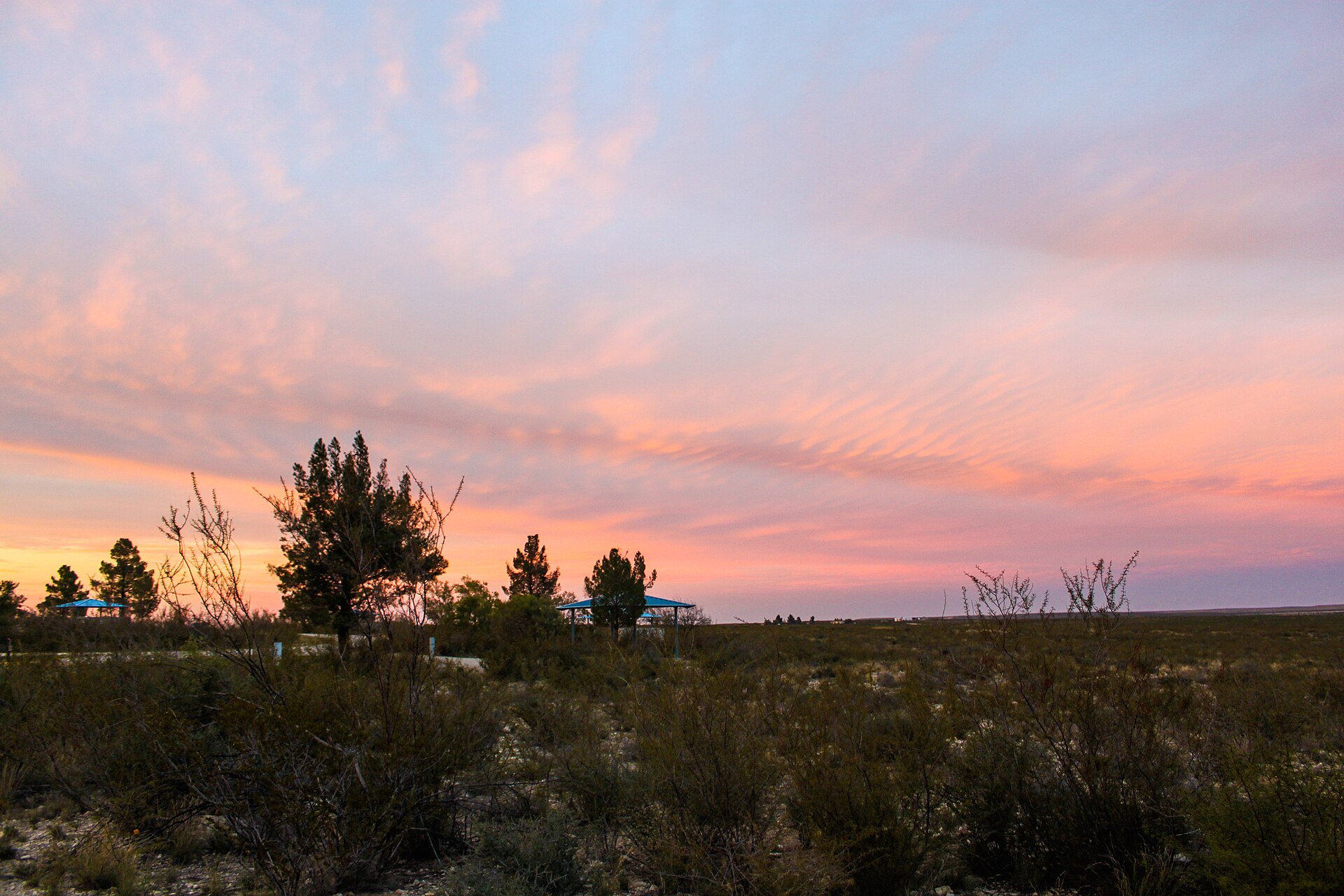
Brantley Lake, Avalon and the Carlsbad Project, Red Bluff Reservoir, and Lake Carlsbad play different roles in irrigation delivery, flood control, cross-border operations, and public life. Their names belong in one water story, but their storage, operators, and legal obligations cannot be interchanged.
Brantley Lake and Dam act as the region’s safety valve, providing flood control while banking water for irrigation. Upstream, the Avalon/Carlsbad Project functions like the switchyard, moving water into fields on time and to the right places. Downstream at the New Mexico–Texas line, Red Bluff Reservoir serves as the cross-border bucket, linking New Mexico’s operations to Texas deliveries. Through town, the Pecos becomes Lake Carlsbad, the community’s front porch with shaded paths, paddle craft, and festivals right on the river.
Why It Matters
These features turn a boom-and-bust river into something families and farmers can count on and something visitors will travel to enjoy.
Where Value Is Created Now
Spring releases for planting, summer levels for parks and boating, ramp access for outfitters. Periodic bathymetric surveys (lake “checkups”) track sedimentation so lost storage can be addressed with dredging or upstream erosion fixes.
What to Watch
Silt in the bottoms, docks high and dry in drought, and upkeep of the little things like signage, restrooms and ramps that make the experience work while protecting water quality.
Headwaters & Community Lakes: Rio Hondo, Grindstone, Bonito, Sitting Bull Falls
Mountain streams and lakes are both civic amenities and part of the region’s water and flood story.
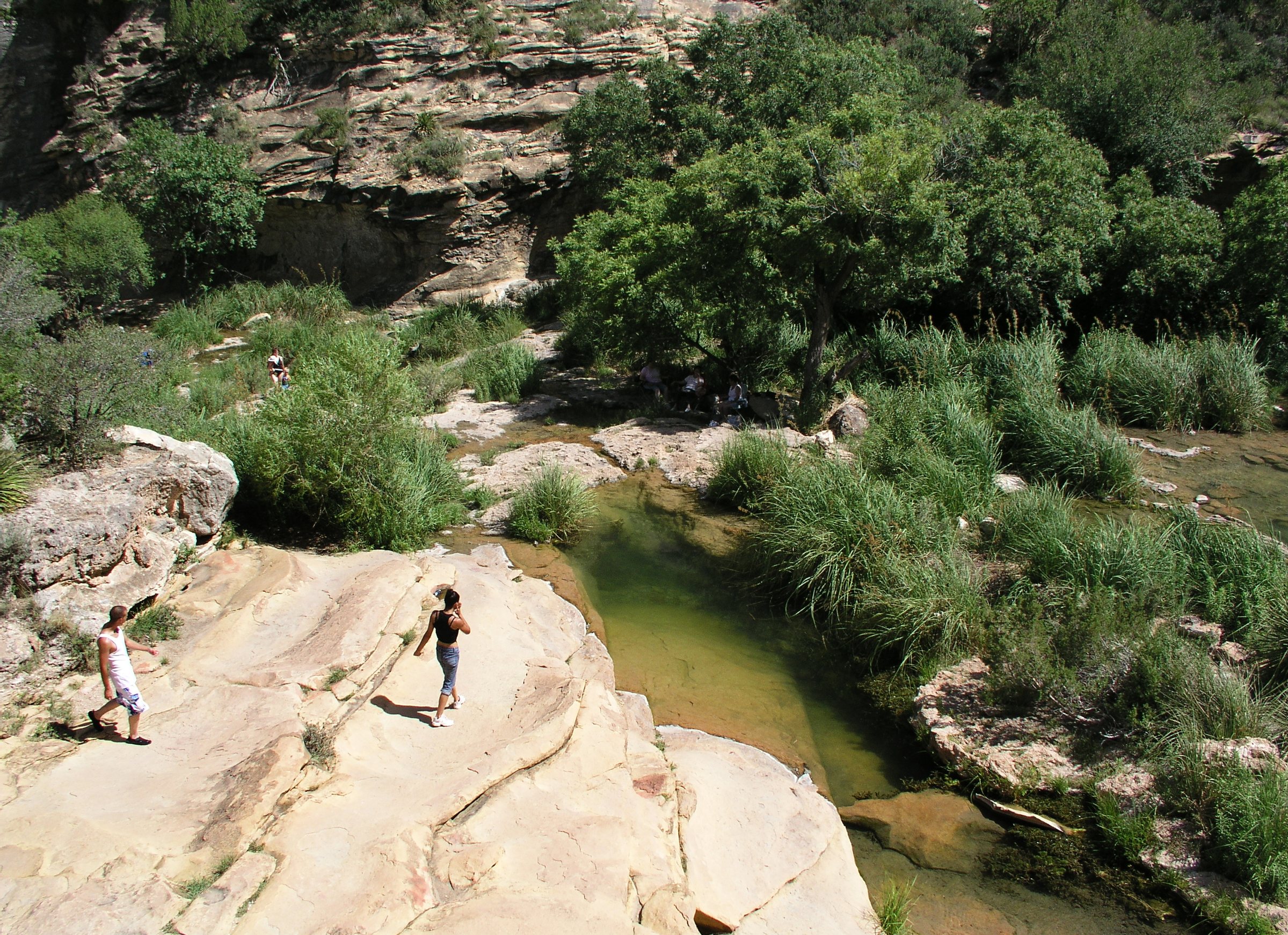
The Rio Ruidoso and Rio Bonito form the Rio Hondo system. Grindstone Lake, Bonito Lake, and Sitting Bull Falls bring residents and visitors close to water, while the surrounding basins influence supply and storm risk. A lake outing and a municipal water plan should share condition information even though they answer different questions.
The Rio Ruidoso and Rio Bonito join to form the Rio Hondo which are cool headwater streams that can flash after storms and send that energy toward the Pecos. In Ruidoso, Grindstone Lake offers after-work paddles, weekend outings, and a growing trail network, while nearby Bonito Lake, a mountain reservoir that helps keep Alamogordo’s taps on, is currently listed by the City of Alamogordo as open for fishing only after watershed recovery work. Rounding out the set, Sitting Bull Falls is a spring-fed cascade that turns a hot day into a field trip.
Why It Matters
These places stitch together water, tourism, and municipal reliability— headwaters for both the economy and the faucet. Families come for trails and water play; water managers watch these basins to gauge flood risk and supply.
Where Value Is Created Now
Event weekends and trailheads fill rooms and tables in nearby towns. Small utilities increasingly rely on simple SCADA/telemetry (tank levels, flows) to react faster to flash events or power blips and keep pressure up for fire protection.
What to Watch
Post-fire runoff and debris flows can rise sharply after storms, but the magnitude depends on burn severity, soils, and rainfall. Culvert sizing, debris management, and alert systems should rely on site-specific engineering and current watershed assessments.
The City of Alamogordo lists Bonito Lake as open for shore fishing only following recovery work. Check the city and land manager for current access before publishing a trip.
What the Evidence Means
Key Insights
Regional implications from the CEDS evidence. A specific project still needs current local measurements, operator records, and community review.
Treat Forests as Water Infrastructure
Fuel work, meadow and spring restoration, erosion control, and post-fire drainage influence water quality and public safety beyond forest boundaries. Their benefits should be evaluated alongside roads and utility projects.
Protect Habitat While Keeping Access Useful
Trails, trailheads, and visitor services can support gateway businesses, but sensitive meadows, springs, and species need route design and maintenance led by land managers. A reliable, well-kept experience is a stronger asset than an overstretched one.
Match Water Investments to the System
Groundwater, reservoirs, canals, and community lakes need different measures. Wellfield yield and quality, storage lost to sediment, delivery reliability, and safe public access should not be collapsed into one regional water number.
Plan Fire and Flood Together
A severe fire can change runoff and debris movement toward the Bonito and Hondo corridors. Upstream fuels and watershed work, culverts and bridges, warning systems, and local evacuation routes should be sequenced as one resilience program.