 CEDS
CEDSSummary Background Land, Resources & Culture
Eco-Tourism & Natural Landmarks
Turn Remarkable Places Into Responsible Stays
Move from caverns and desert falls through refuge wetlands, mountain towns, wilderness, dunes, and science heritage with access and stewardship in view.

The Landscape That Shapes Us Eco-Tourism & Natural Landmarks
Eco-Tourism & Natural Landmarks
Caves, springs, wetlands, lava, forests, wilderness, gypsum dunes, and dark skies give Southeastern New Mexico an unusually varied visitor geography. Carlsbad, Roswell, Ruidoso and Alto, Carrizozo, Alamogordo, Cloudcroft, and smaller gateways can turn a landmark visit into meals, lodging, guides, museums, and another day in the region.
That benefit depends on the quality and accuracy of the trip. Federal, state, tribal, municipal, and private places have different access rules and conservation missions. Current closures, heat and fire conditions, trail repair, wayfinding, and visitor amenities should shape any shared itinerary. The source profiles below describe opportunities; the managing agency remains the authority on today’s access.
Carlsbad Caverns National Park
A flagship cave landscape connects scientific protection with a wider Carlsbad gateway economy.
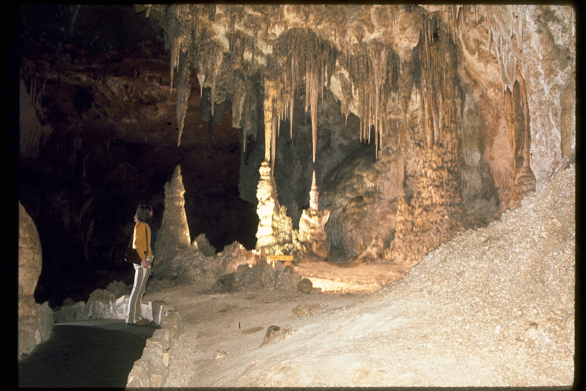
Carlsbad Caverns is both a protected scientific landscape and a flagship reason to travel to Eddy County. The economic opportunity is in the wider visit: quality information, lodging, food, museums, and riverfront experiences that can support a longer stay without increasing pressure inside the cave.
A Park Experience With a Gateway Economy
Carlsbad Caverns protects a cave system and desert landscape that visitors cannot experience elsewhere. The park trip also depends on accommodation, food, roads, and visitor information in and around Carlsbad. Timed cavern entry and tour availability are managed by the National Park Service; visitors should check the park's own planning page before travel. The regional economic question is whether a cave visit becomes a longer, well-served stay without putting additional pressure on the resource.
Connect the Trip Thoughtfully
A useful itinerary can pair a park day with a city museum, riverfront stop, Living Desert visit, or another accessible experience. These destinations have different operators, hours, and fees, so a joint visitor guide must be maintained rather than published once and forgotten. Wayfinding and reliable service information help small businesses benefit when travelers choose a second meal or night.
A Practical Planning Lens
Before the Visit
Give visitors accurate entry, reservation, heat, and travel information from the park.
During the Stay
Connect the cave experience with local services and a second nearby attraction.
After the Visit
Track whether visitors stay overnight and whether gateway needs are being met.
Protect What Creates the Demand
Cave formations, bats, and underground conditions require careful visitor management. The park sets access and biosecurity requirements; gateway partners can reinforce those messages instead of improvising their own. Measures worth tracking include visitor satisfaction, overnight stays, local business participation, and the maintenance needs of shared routes and facilities—not just attendance at the cave entrance.
Sitting Bull Falls
A spring-fed desert waterfall can extend a Carlsbad-area trip when access and fragile pools are protected.
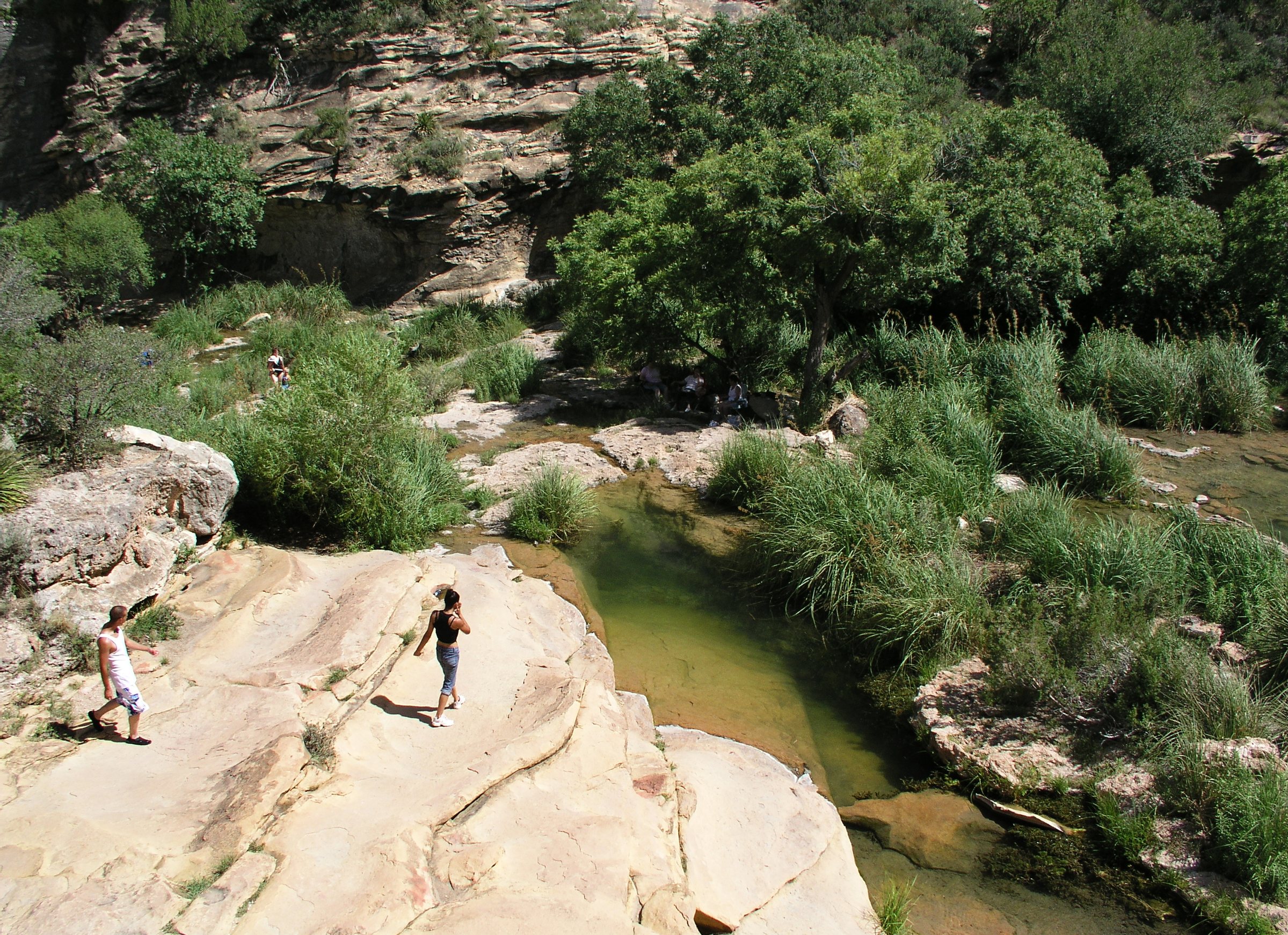
Sitting Bull Falls places a spring-fed cascade and shaded day-use area in a desert canyon. The contrast is memorable, and a well-planned half-day visit can connect with Carlsbad-area meals, lodging, or a second cultural stop. The site is also a sensitive water and karst environment, so visitor volume, parking, and trails must fit the landscape.
The source profile links economic value to ordinary services: clear access information, safe paths, picnic space, and maintenance after flood events. A regional visitor guide should confirm the Forest Service’s current operating conditions and explain heat, water, and travel time before recommending the trip.
Bitter Lake National Wildlife Refuge
Wetlands and wildlife viewing make a distinct Roswell-area nature visit that depends on habitat-first access.
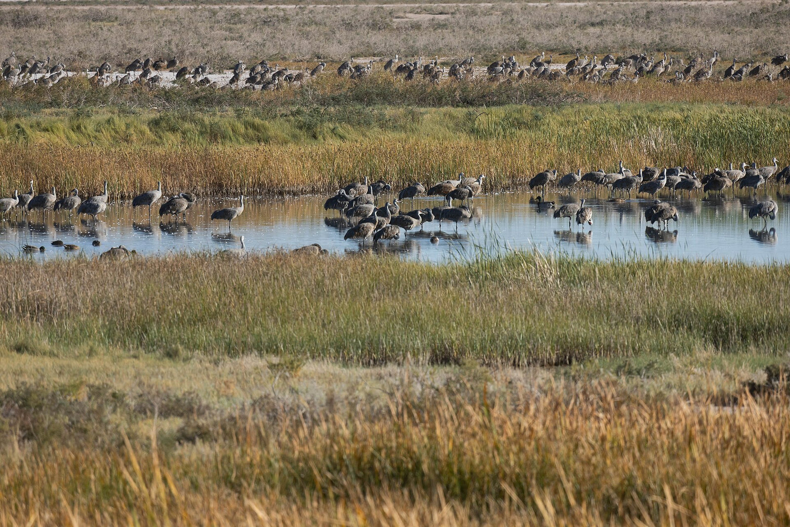
Bitter Lake National Wildlife Refuge near Roswell is a wetland and desert habitat destination, especially for birding, dragonfly observation, photography, and education. Its conservation purpose comes first. Boardwalks, trails, and viewing areas direct visitors toward places where people can learn without damaging the habitat they came to see.
The regional opportunity is to make a refuge visit part of a fuller Roswell trip, with accurate seasonal information and local meals, museums, or lodging. Wildlife appearances and festival programs vary; the refuge should remain the source for current access and events.
Ruidoso & Alto
Mountain access, arts, lakes, and Mescalero Apache venues support year-round visits amid fire and flood recovery.
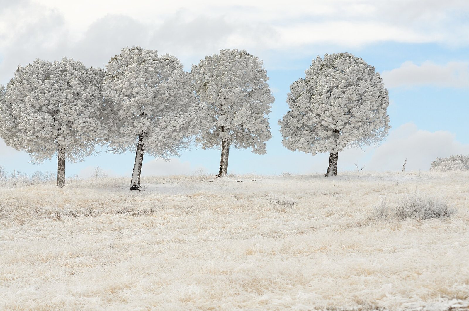
Ruidoso and Alto connect forest routes, lakes, arts, winter activity, and Mescalero Apache visitor venues. Fire and flood recovery affects the roads, trails, and confidence that make a trip workable. Current conditions and Tribe-directed information should guide a shared itinerary.
A Different Climate and Economy
The Sacramento Mountains and nearby communities offer forest access, cooler summer conditions, winter activities, arts, lodging, and a distinctive history. The Lincoln National Forest spans several districts, so a visitor's trip may cross municipal, tribal, federal, and private lands. Local businesses can benefit when events, trails, food, and accommodation form a coherent stay rather than competing as isolated stops.
Recovery Is Part of Destination Quality
Fire and subsequent flooding can alter trail access, roads, drainage, and the reliability of a trip. The region should treat condition updates, repair sequencing, and honest route information as visitor infrastructure. A closed trail is not a failed tourism product if travelers can find a safe alternative and know what is open before leaving home.
A Practical Planning Lens
Open Routes
Keep trail, road, and hazard information current after fire or storms.
Town Connections
Pair outdoor experiences with downtown events, food, and lodging.
Recovery
Treat drainage, trail repair, and business continuity as one destination agenda.
Who Needs to Coordinate
Forest managers determine federal access and closures; towns, the Mescalero Apache Tribe, businesses, and other landowners make decisions for their own places. A joint calendar or wayfinding project should respect those roles. Useful measures include open-route information, repaired facilities, shoulder-season stays, and local business participation, with each partner defining its contribution.
Valley of Fires Recreation Area
An accessible lava-flow stop links geology, camping, and the Carrizozo gateway.
Valley of Fires Recreation Area makes the Carrizozo lava flow legible through a developed trail and camping. A short, accessible geology stop can support nearby food and retail while helping travelers understand the land between mountain and basin destinations.
Its value depends on a clear, safe visit: heat guidance, current hours, trail surfaces, shade, sanitation, and interpretation that makes the lava’s story understandable. Improvements should be planned with the Bureau of Land Management and the partners who will maintain them.
White Mountain & Capitan Mountains Wilderness
Backcountry value depends on maintained portals, accurate route conditions, and wilderness protection.
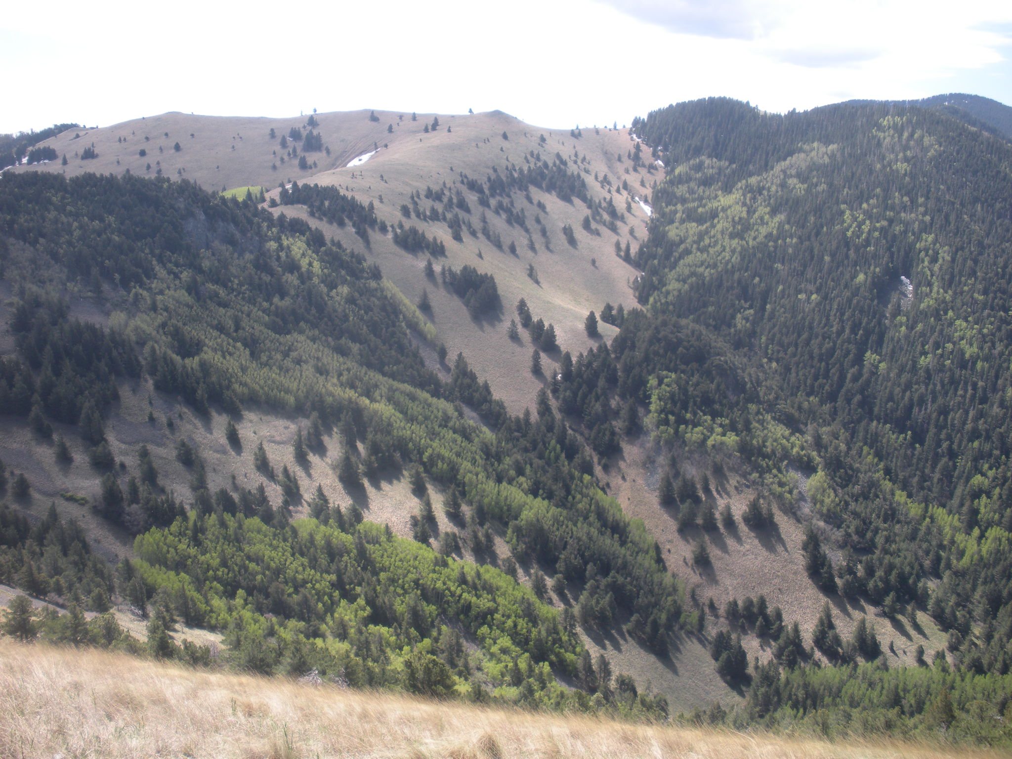
White Mountain and Capitan Mountains Wilderness offer backcountry routes and a strong conservation identity near Lincoln County communities. Wilderness experience depends on the condition of access roads and trailheads as well as the protection of the land beyond them.
A useful visitor guide identifies route difficulty, conditions, travel time, water, weather, and the restrictions that apply to a designated wilderness. After fire or storms, drainage and trail repair determine whether the trip is feasible. Guides and outfitters can add value where access and permits allow.
White Sands National Park
The gypsum dunefield anchors an Otero County visit and requires planning around heat, storms, and temporary closures.
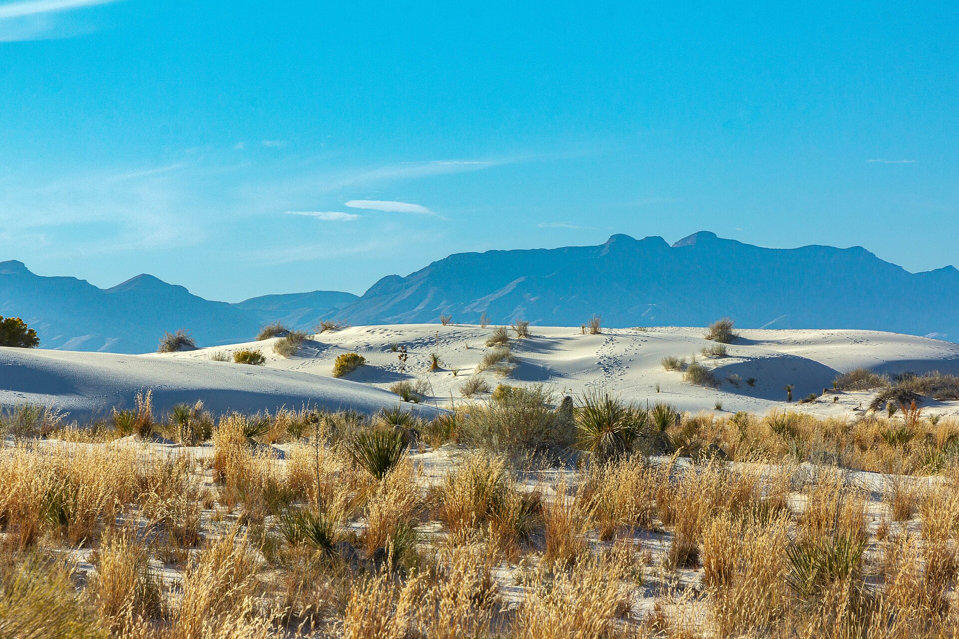
The gypsum dunes give Otero County a globally distinctive landscape. Dunes Drive and park hours may change for missile-range testing or weather, so a good regional trip includes current park alerts and a genuine alternate stop.
A Defining Place in the Tularosa Basin
White Sands gives visitors a memorable landscape and gives nearby communities a reason to offer a fuller stay. Alamogordo, Tularosa, and mountain destinations can provide museums, food, lodging, and a second day of experiences. The park itself is managed for resource protection and visitor safety; a regional itinerary should support its mission rather than treat the dunes as a setting for unlimited new use.
Plan for Real Access Conditions
The National Park Service says Dunes Drive may close during missile-range tests, and highway travel can also be affected. Weather and seasonal hours matter as well. A good visitor guide links directly to the park's current notices, helps travelers plan for heat and limited services, and offers a genuine alternate stop when access changes. Static promises about openings quickly become unreliable.
A Practical Planning Lens
Plan
Use current park information for access, heat, weather, and possible closures.
Explore
Connect a park day with the wider Otero County landscape and its communities.
Stay Longer
Give visitors an appealing second-day itinerary without adding pressure to fragile dunes.
From Day Trip to Regional Stay
The useful economic-development work lies outside the dunes: walkable evening activity, clear wayfinding, welcoming visitor information, and links to existing attractions. Partners can test whether visitors find and use those options through lodging and business feedback. Any proposed shuttle, event, or package needs a sponsor, operating plan, and agreement with the relevant land manager.
Oliver Lee Memorial State Park
Dog Canyon ties desert ecology and ranch history to hiking, camping, and nearby Alamogordo services.
Oliver Lee Memorial State Park links ranch history and Dog Canyon to a desert-to-mountain trail experience near Alamogordo. It can offer a second day for White Sands visitors, but the easy riparian setting and demanding canyon ascent are not the same outing.
Clear trail difficulty, heat and water guidance, campsite information, and maintained signs help visitors choose a safe trip. Meals and lodging nearby can benefit when routes and hours are easy to plan around.
Sunspot Solar Observatory & Apache Point
Science heritage remains compelling, but public access differs sharply between the two observatories.
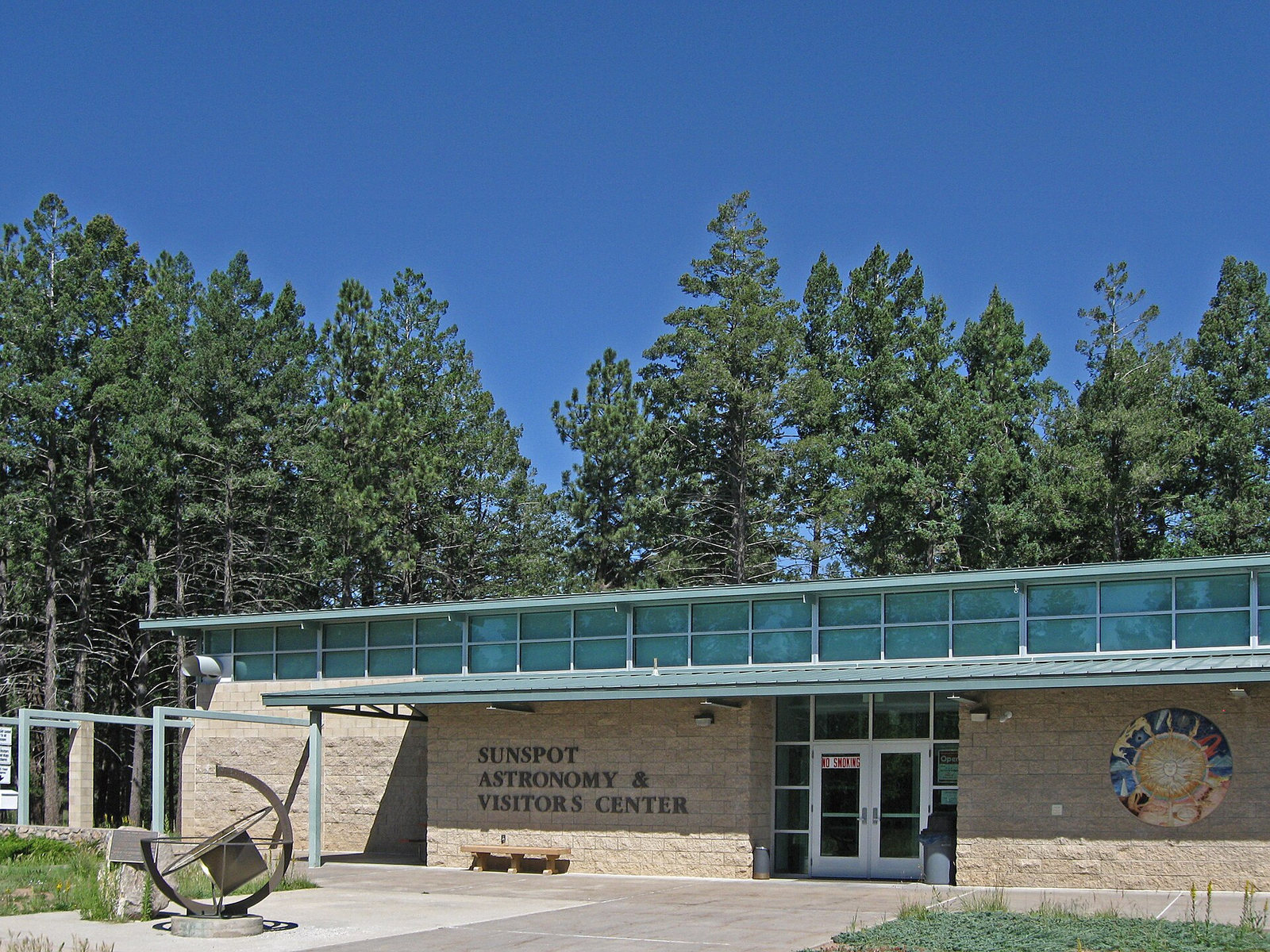
The Sacramento Mountains’ observatories give the region a distinctive science story. Sunspot Solar Observatory and Apache Point Observatory are research facilities with different operators and access conditions. They should not be advertised as interchangeable walk-in attractions.
New Mexico State University says Sunspot Observatory, its visitor center, nearby grounds, and local trails are closed to the public. Apache Point publishes its own public-visit information; any itinerary should use the current operator schedule rather than promise a tour. The New Mexico Museum of Space History in Alamogordo provides a dependable public-facing way to explore regional science and space history.
What the Evidence Means
Key Insights
Regional implications from the CEDS evidence. A specific project still needs current local measurements, operator records, and community review.
Make the Second Stop Easy to Find
Landmarks bring a visitor into the region; clear travel times, hours, routes, food, lodging, and evening choices determine whether the trip supports more local firms. Measure overnight stays and business participation rather than assuming every attraction extends a visit.
Invest in the Ordinary Details
Shade, water, restrooms, parking, accessible surfaces, signs, and trail maintenance shape safety and the experience at caves, falls, refuges, dunes, and wilderness portals. Each improvement needs a managing partner and an operating budget.
Publish Current Conditions
Wildfire recovery, monsoon damage, heat, weather, and testing closures can change a trip quickly. A maintained regional guide should link to land-manager notices and offer accurate alternate routes and activities.
Keep Conservation in the Itinerary
Karst pools, cave environments, wetlands, rock art, and wilderness are the reason people travel. Visitor design should direct use to suitable places and follow federal, state, tribal, and private land rules.